
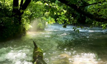


Jacks Fork River

photo courtesy of Mark Pelton
Jack’s Fork River
The Jacks Fork River is formed by the confluence of two streams: the North Prong and South Prong of the Jacks Fork. The North Prong has its beginnings approximately 9 miles south of Raymondville, Missouri, while the headwaters of the South Prong are located approximately 5 miles east of Cabool, Missouri. Both streams join to form the Jacks Fork River northwest of Mountain View, Missouri. From this point, the Jacks Fork flows in an easterly direction for 49.1 miles before joining the Current River northeast of Eminence, Missouri.

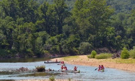
Alley Mill
photo courtesy of Mark PeltonAlley Mill Alley Spring, the natural area’s namesake, is the seventh largest spring in Missouri. The spring conduit is known to extend at least 3000 feet underground and reaches at least 155 feet below the surface. Rainfall and runoff...
Did You Know?
The Jacks Fork Watershed occupies a land area of 445 square miles in portions of Howell, Shannon, and Texas Counties.

Enjoying The River
There are many activities that you can enjoy on the current river. Please remember to be courteous to other river users.
- Don't throw trash in the water or on the banks, pack it out with you.
- Bring plenty of water and food, and don't overdo it.
- Plan your floating/paddling route, including potential emergency exit points, before getting in the water.
- Be aware of local and state laws for the area, including safety device requirements.


