


Allred Lake Natural Area

Allred Lake Natural Area
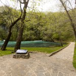
Allred Lake is a small remnant of the once vast network of swamps and bottomland forests that once covered the Mississippi Lowlands of southeast Missouri. Here you can experience a natural scene similar to that found in Louisiana and other gulf coast states. Cypress, water tupelo, overcup oak, and water locust ring the slough called Allred Lake. Mature bald cypress trees are highly tolerant of saturated or flooded soils. The cones and scales float which is the primary method of seed dispersal. The wood of mature cypress is very rot resistant and is desired for fencing, boat planking, piers, siding and shingles.
Did You Know?
Allred Lake is a small remnant of the once vast network of swamps and bottomland forests that once covered the Mississippi Lowlands of southeast Missouri.
Directions to Allred Lake
From Neelyville, travel east on Highway 142 about 5 miles. Then turn right (south) onto Highway H. Travel south on Highway H for 2.5 miles. At this point Highway H ends and a gravel county road begins. Follow this gravel county road for a half mile. Then turn left (south) onto another gravel road and follow this less than a half mile to the entrance of the area on your left (east) side. From the area parking lot a short trail leads to a boardwalk and overlook above the slough waters. Fishing is not permitted here due to the rare fish species inhabiting the small slough.
Allred Lake Natural Area


