


Rocky Falls
Rocky Falls
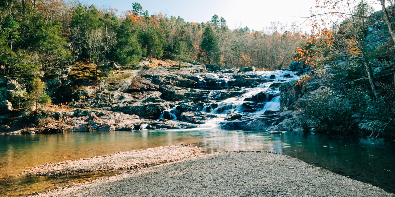
Few places in the Ozarks provide a glimpse of earth’s turbulent past as well as Rocky Falls. Normally, a stream eroding softer dolomite, a type of limestone, would make a wider valley for itself. Since the rhyolite is harder, the stream tends to stay within whatever cracks that it finds, deepening them only a little by erosion. Thus a“shut in” is formed where the harder rock has “shut in” the stream. Farther downstream, past the constricting rhyolite, the stream valley widens once again. This allows the stream to expand into a pool.
Did You Know?
One of Missouri’s most scenic spots, Rocky Falls has stunning views of water cascading 40 feet over igneous rock and is accessible by car. Access to Current River Section of the Ozark Trail is available.
Directions to Rocky Falls
From Van Buren, take Hwy 60 west 20 miles to Winona, then North on Hwy 19, one mile, then right on H Hwy several miles to Hwy NN. Turn right on NN, and follow signs. Area Attractions include picnicking, swimming, restrooms, hiking and fishing.
ADDRESS
County Rd NN-526
Winona, MO 65588, USA
Rocky Falls


