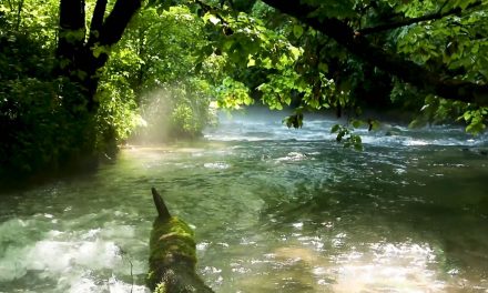


Paddling the Mingo Canoe Trail
If I shared with you an opportunity to kayak, canoe or stand-up paddleboard through an ancient
abandoned channel of the Mississippi River in a wild wetland complex on the edge of the
Ozarks, would you believe it to be real? For a chance to float by stately cypress trees and
paddle alongside bald eagles or beavers, look no further than the Mingo National Wildlife
Refuge’s Mingo Canoe Trail.

The drop in this portion of the Mingo
River is miniscule, clocking in at under a
foot. The low and flat topography here
provides ample opportunity for solitude,
wildlife viewing, and a relaxing float trip
which can be paddled in either direction.
Long ago, the Mississippi River flowed
through this area before moving east of
Crowley’s Ridge, a linear geological formation that towers 250 to 500 feet
above the surrounding landscape.
The 5.6-mile designated canoe trail is
best accessed on its southern end via a
primitive canoe launch on the Mingo
River. To get there from the Refuge’s
southeastern entrance, travel 1.2 miles
north of the Mingo Job Civilian Corps Conservation
Center on Bluff Road. Then turn left and travel west
for .6 miles on County Road 280, staying left at the
next road intersection. Drive until you see the small
parking area on the right side of the road, just
before the river flows under the bridge.
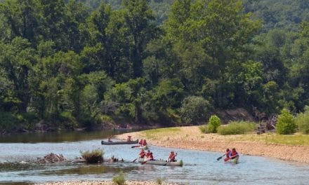
After paddling north for a little over a mile, the
canoe trail loop begins. The eastern route follows
the winding Mingo River and the western option is
known as Ditch #10. Don’t be fooled by its name,
the ditch was excavated by farmers a century ago in
an attempt to drain the wetland in search of
suitable cropland. It is now a sublime forested flatwater corridor. When the two waterways
converge on the north end of the loop, you can float the other channel back to your vehicle or
continue northbound to another boat launch on the western edge of Monopoly Marsh, 1.3
miles away. A digital map and compass here are a must since there is no signage in the
wilderness and cell service is unreliable. Keep an eye out for turtles, fish, osprey, white-tailed
deer, and various bird species. Major tree species include bald cypress, water tupelo, overcup
oak, and silver maple.
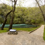
Protected in 1944 under the Migratory Bird Treaty Act, Mingo is a sprawling network of rivers,
wetlands, man-made ditches, and bottomland forest habitat. Sprinkle in some Ozark foothills
topography to the west and east and you have a recipe for an outstanding recreation
destination, with serious odds of seeing more wildlife than people. 7,730 acres of the Refuge’s
21,592 acres are permanently protected as the Mingo Wilderness. Passed in 1964, the
Wilderness Act is the nation’s gold standard for federal land protection. This area is closed to
motorized and mechanized use and the only way to access it is with a motorless boat.
Trip Overview
Time: 4-6 hours
Distance: 5-10 miles
Skill level: Moderate
Fees: None
Maps: Refuge Map and Mingo Canoe Trail Map
Directions: Southern access point from Poplar Bluff
Best season: Spring and fall – some waters in the
Refuge close seasonally, check Mingo’s website for
updates here.
Essentials: Canoe, kayak or stand-up paddle board;
digital map/GPS, personal floatation device, water,
sunscreen, cell phone and plenty of food
Leave No Trace Ethics: pack out all trash, do not
disturb wildlife or their habitat